
地図の物語
国の大きさや投影法の選び方、国境線のデータについて読み、地図で確かめてみましょう。
地図を開く →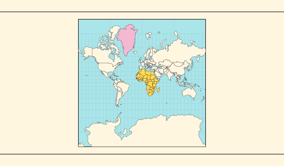
グリーンランドが大きく見える理由
メルカトル図法は極に近い地域を引き伸ばします。そのためグリーンランドは赤道付近の国に比べ、面積以上に大きく見えます。Equal Earth でグリーンランドとオーストラリアを探し、輪郭を比べてみましょう。航海に便利な地図が、面積比較にも適しているとは限りません。
記事を読む →
Equal Earth が保つもの
球面を平面にすると何かが変わります。Equal Earth は相対的な面積を保ち、国の大きさ比較に役立ちますが、形・距離・方向をすべて保つことはできません。地球儀の端では形が圧縮されます。知りたいことに合った地図を選びましょう。
記事を読む →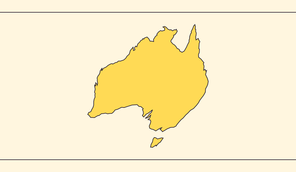
国境と面積が異なる理由
地図の簡略化で小さな湾や島が省かれます。この地図は Natural Earth の縮尺1億1千万分の1の境界を使い、簡略化した球面形状から面積を計算します。公式統計では水域や領土の定義が異なる場合があります。≈ は推定値の印です。
記事を読む →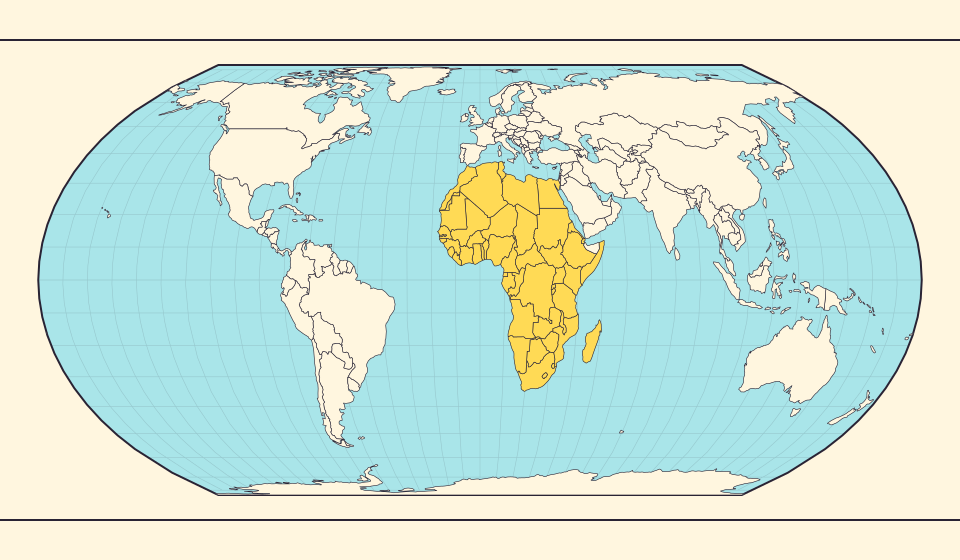
Africa is bigger than the map in your memory
The equator crosses Africa, but familiar rectangular maps give northern regions extra space. Compare Africa with countries you know to get a sense of its size.
記事を読む →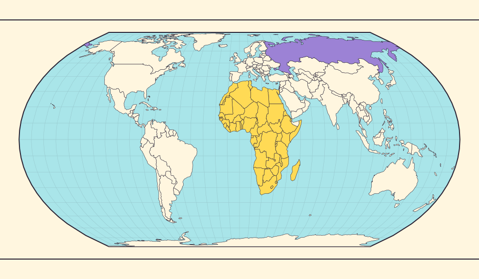
Russia and Africa: width is not area
Russia stretches across the top of many world maps. Compare that visual width with area, and learn why a country and a continent need different labels.
記事を読む →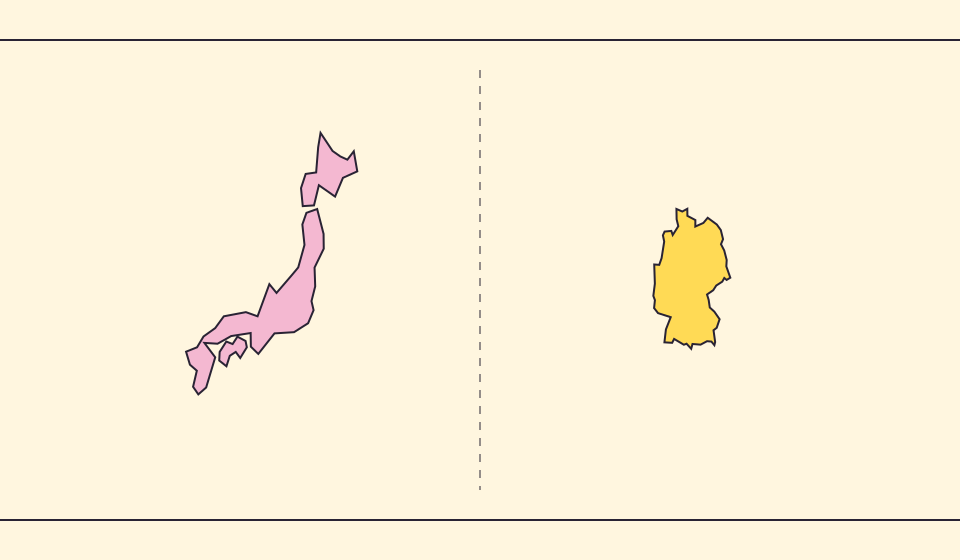
Japan and Germany: a long shape can hide a similar area
An island chain and a compact mainland country look very different. Compare area without confusing the sea between islands with land.
記事を読む →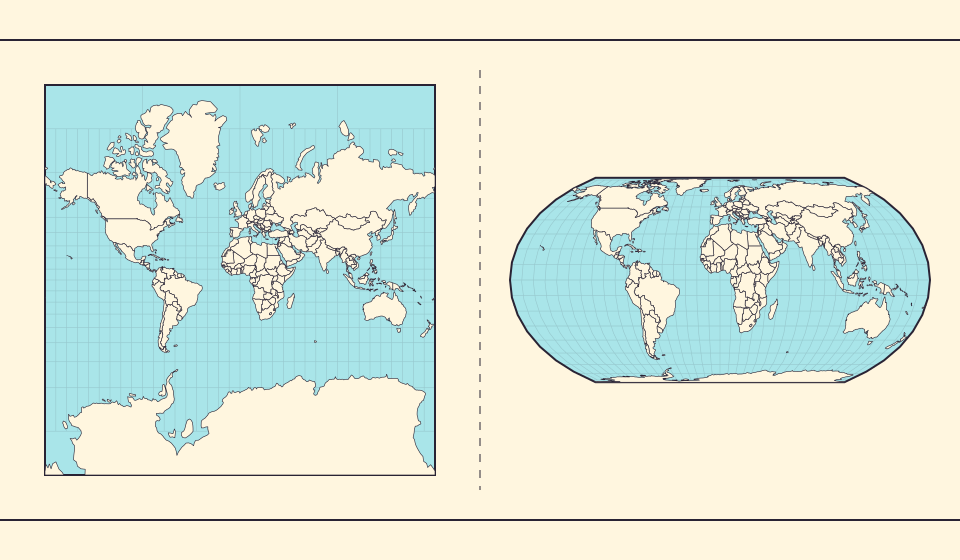
Why online maps stop before the poles
Square tiles make a world map easy to zoom, but Mercator cannot place the poles at a finite height. Learn what the missing polar strip means.
記事を読む →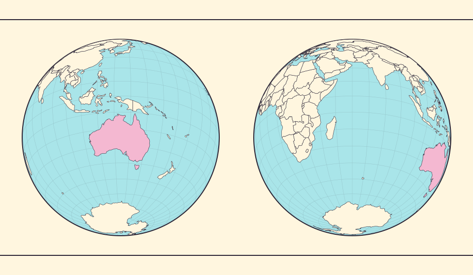
Why a country looks smaller at the globe’s edge
A globe avoids the familiar rectangular world, but its screen image still compresses the edge. Separate spherical area from visible footprint.
記事を読む →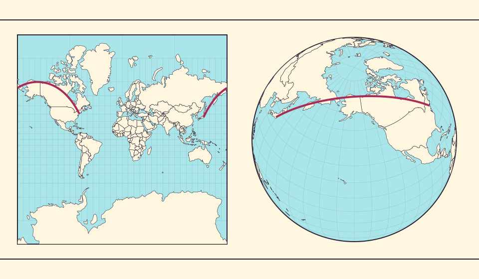
Why the shortest flight looks curved on a map
A straight line on the screen need not be the shortest path around Earth. Compare great-circle paths with compass bearings, and see what a route illustration can tell you.
記事を読む →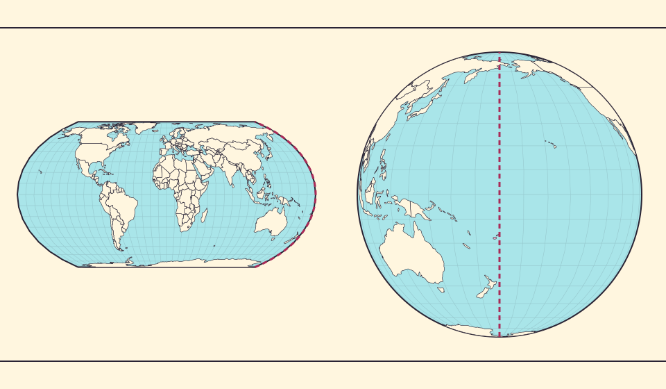
The map edge is not the International Date Line
Longitude wraps around, a flat map has a seam, and calendar dates have a boundary. These three ideas are related but not identical.
記事を読む →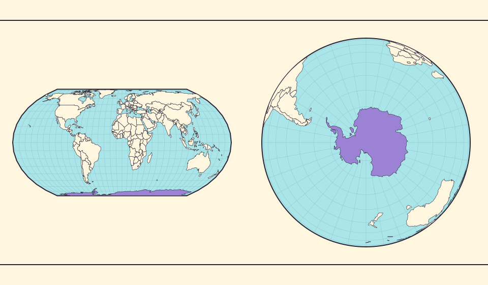
Antarctica is a continent, not the bottom border
A stretched southern strip can hide the shape of a whole continent. Compare Antarctica on Mercator, Equal Earth and a polar globe view.
記事を読む →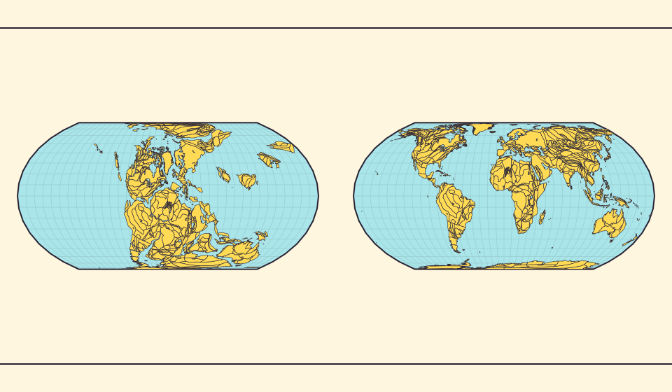
Pangaea was not there at the start of every timeline
At 600 million years ago, Pangaea had not yet assembled. Follow separated landmasses as they come together and later drift apart.
記事を読む →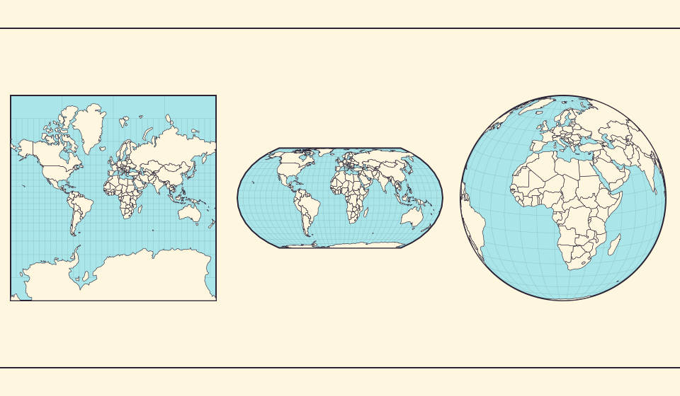
Five questions before sharing a “true world map”
Projection, zoom, viewpoint, source detail and the meaning of area all affect how you read a map. Check these before sharing a comparison screenshot.
記事を読む →