
Térképtörténetek
Ismerd meg a területeket, vetületeket és határadatokat, majd ellenőrizd a térképen.
Térkép megnyitása →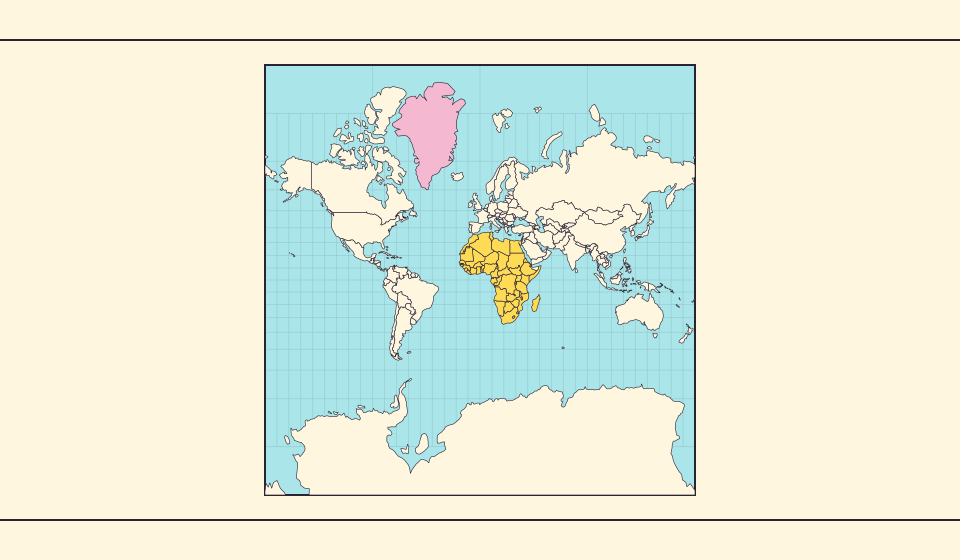
Miért látszik Grönland ilyen nagynak?
A Mercator-térképek megnyújtják a pólusokhoz közeli területeket. Grönland így túl nagynak látszik az egyenlítő környéki országokhoz képest. Hasonlítsa össze Grönlandot és Ausztráliát az Equal Earthön. A navigációra hasznos térkép nem feltétlenül jó területek összehasonlítására.
Olvasd el a történetet →
Mit őriz meg az Equal Earth?
A gömb síkba vetítése megváltoztat bizonyos tulajdonságokat. Az Equal Earth megőrzi a relatív területeket, de nem minden alakot, távolságot és irányt. A földgömb szélén az alakok összenyomódnak. Válasszon nézetet a kérdéséhez.
Olvasd el a történetet →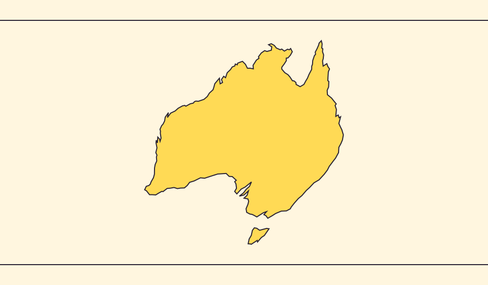
Miért térnek el határok és területek?
Az egyszerűsítés kis öblöket és szigeteket hagy el. Natural Earth határokat használunk 1:110 milliós méretarányban, és egyszerűsített gömbi alakokból számítunk területet. A hivatalos adatok másképp számolhatják a vizeket és területeket. A ≈ becslést jelöl.
Olvasd el a történetet →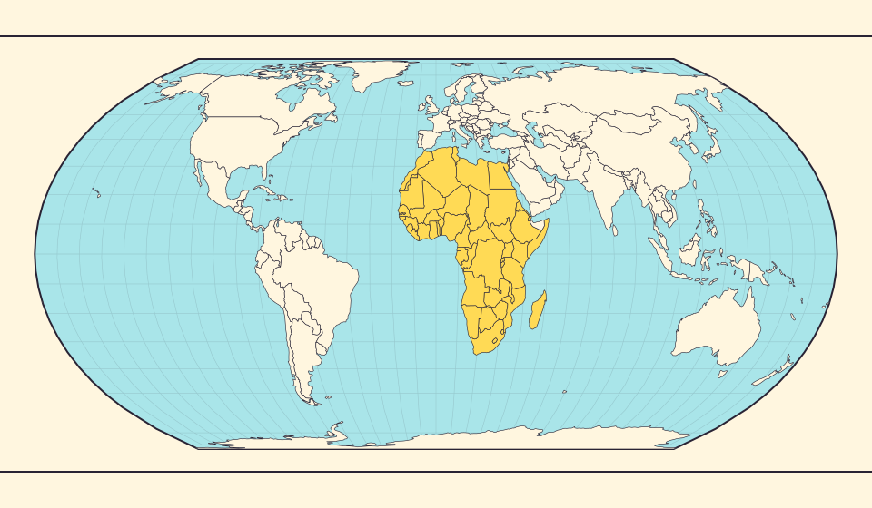
Africa is bigger than the map in your memory
The equator crosses Africa, but familiar rectangular maps give northern regions extra space. Compare Africa with countries you know to get a sense of its size.
Olvasd el a történetet →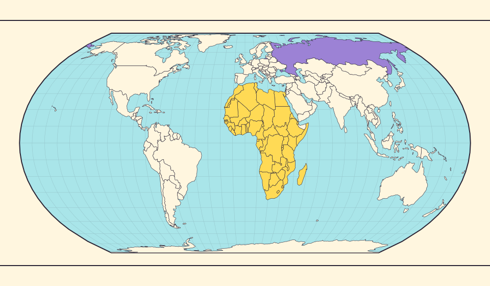
Russia and Africa: width is not area
Russia stretches across the top of many world maps. Compare that visual width with area, and learn why a country and a continent need different labels.
Olvasd el a történetet →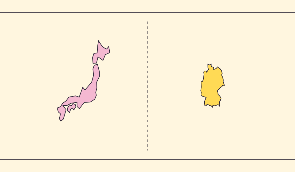
Japan and Germany: a long shape can hide a similar area
An island chain and a compact mainland country look very different. Compare area without confusing the sea between islands with land.
Olvasd el a történetet →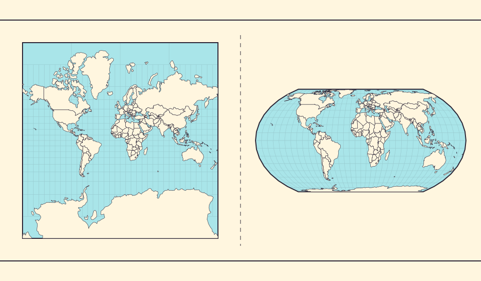
Why online maps stop before the poles
Square tiles make a world map easy to zoom, but Mercator cannot place the poles at a finite height. Learn what the missing polar strip means.
Olvasd el a történetet →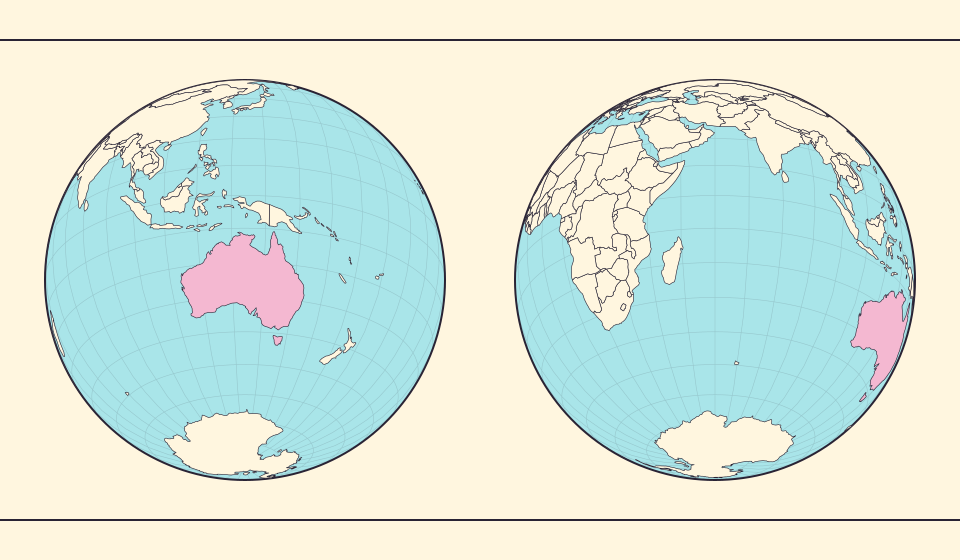
Why a country looks smaller at the globe’s edge
A globe avoids the familiar rectangular world, but its screen image still compresses the edge. Separate spherical area from visible footprint.
Olvasd el a történetet →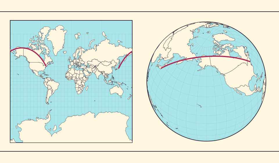
Why the shortest flight looks curved on a map
A straight line on the screen need not be the shortest path around Earth. Compare great-circle paths with compass bearings, and see what a route illustration can tell you.
Olvasd el a történetet →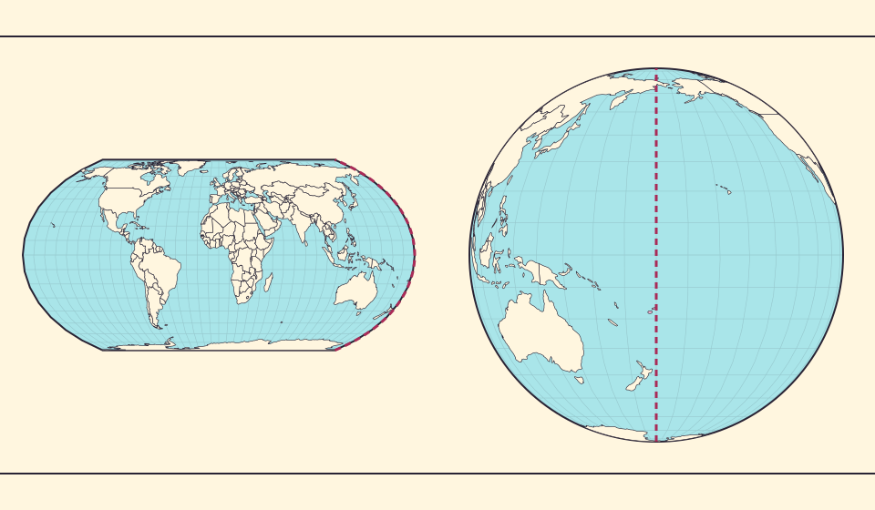
The map edge is not the International Date Line
Longitude wraps around, a flat map has a seam, and calendar dates have a boundary. These three ideas are related but not identical.
Olvasd el a történetet →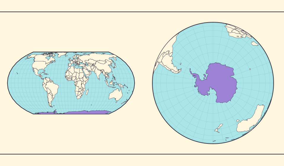
Antarctica is a continent, not the bottom border
A stretched southern strip can hide the shape of a whole continent. Compare Antarctica on Mercator, Equal Earth and a polar globe view.
Olvasd el a történetet →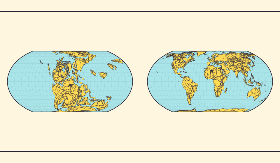
Pangaea was not there at the start of every timeline
At 600 million years ago, Pangaea had not yet assembled. Follow separated landmasses as they come together and later drift apart.
Olvasd el a történetet →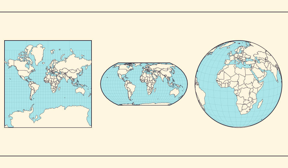
Five questions before sharing a “true world map”
Projection, zoom, viewpoint, source detail and the meaning of area all affect how you read a map. Check these before sharing a comparison screenshot.
Olvasd el a történetet →