
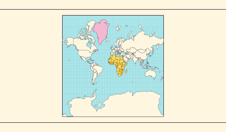
格陵蘭為什麼看起來那麼大?
麥卡托地圖會放大靠近兩極的地區。因此,與赤道附近的國家相比,格陵蘭可能顯得比實際更大。在 Equal Earth 上搜尋格陵蘭和澳洲,比較它們的輪廓。熟悉的地圖是否影響了你的判斷?適合航行的地圖未必適合比較面積。
地圖改變了什麼
球面麥卡托投影的局部面積倍率為 1 / cos²(緯度)。緯度60°的一小塊土地在圖上占據赤道同面積土地的四倍。這不是整個國家的倍率。它保留局部角度,卻在兩極附近放大面積。
來源: Statistics Greenland · Greenland in Figures 2025, p. 34 · USGS · Map Projections: A Working Manual (Snyder, 1987) · USGS · How are different map projections used?
Sources and further reading
Sources checked:
Related stories
Africa is bigger than the map in your memory
The equator crosses Africa, but familiar rectangular maps give northern regions extra space. Compare Africa with countries you know to get a sense of its size.
Equal Earth 保留了什麼
把球面展開成平面必然改變某些特徵。Equal Earth 保留相對面積,適合比較國家大小,但不能同時保留所有形狀、距離和方向。切換到地球儀,觀察邊緣國家的壓縮。根據問題選擇地圖,而不是期待一張地圖解釋一切。
Why online maps stop before the poles
Square tiles make a world map easy to zoom, but Mercator cannot place the poles at a finite height. Learn what the missing polar strip means.