
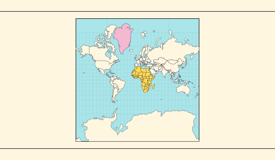
ทำไมกรีนแลนด์จึงดูใหญ่?
แผนที่เมอร์เคเตอร์ขยายบริเวณใกล้ขั้วโลก กรีนแลนด์จึงดูใหญ่เกินจริงเมื่อเทียบกับประเทศใกล้เส้นศูนย์สูตร ลองเปรียบเทียบกรีนแลนด์กับออสเตรเลียใน Equal Earth แผนที่ที่เหมาะกับการเดินเรืออาจไม่เหมาะกับการเปรียบเทียบพื้นที่
แผนที่เปลี่ยนอะไร
ในการฉายเมอร์เคเตอร์บนทรงกลม ตัวคูณพื้นที่เฉพาะจุดคือ 1 / cos²(ละติจูด) ที่ 60° พื้นที่เล็ก ๆ จะกินเนื้อที่บนแผนที่สี่เท่าของพื้นที่เท่ากันที่เส้นศูนย์สูตร ไม่ใช่ตัวคูณของทั้งประเทศ มุมเฉพาะจุดยังคงเดิม แต่พื้นที่ใกล้ขั้วโลกถูกขยาย
แหล่งข้อมูล: Statistics Greenland · Greenland in Figures 2025, p. 34 · USGS · Map Projections: A Working Manual (Snyder, 1987) · USGS · How are different map projections used?
Sources and further reading
Sources checked:
Related stories
Africa is bigger than the map in your memory
The equator crosses Africa, but familiar rectangular maps give northern regions extra space. Compare Africa with countries you know to get a sense of its size.
Equal Earth รักษาอะไรไว้?
การแผ่ทรงกลมเป็นพื้นราบย่อมเปลี่ยนคุณสมบัติบางอย่าง Equal Earth รักษาสัดส่วนพื้นที่ แต่ไม่ได้รักษารูปร่าง ระยะทาง และทิศทางทั้งหมด รูปร่างบริเวณขอบลูกโลกจะถูกบีบ เลือกมุมมองให้เหมาะกับคำถาม
Why online maps stop before the poles
Square tiles make a world map easy to zoom, but Mercator cannot place the poles at a finite height. Learn what the missing polar strip means.