
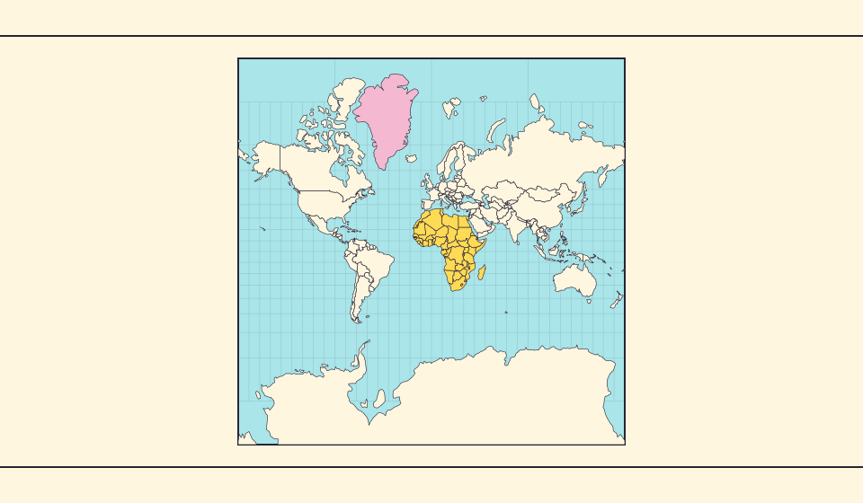
למה גרינלנד נראית כה גדולה?
מפות מרקטור מותחות אזורים סמוכים לקטבים. לכן גרינלנד נראית גדולה מדי ביחס למדינות ליד קו המשווה. השוו את גרינלנד ואוסטרליה ב־Equal Earth. מפה טובה לניווט אינה בהכרח מתאימה להשוואת שטחים.
מה המפה משנה
בהיטל מרקטור כדורי, מקדם השטח המקומי הוא 1 / cos²(קו רוחב). ב־60° חלקה קטנה תופסת פי ארבעה משטח חלקה זהה בקו המשווה. זה אינו מקדם למדינה שלמה. זוויות מקומיות נשמרות, אך השטחים ליד הקטבים מתנפחים.
מקורות: Statistics Greenland · Greenland in Figures 2025, p. 34 · USGS · Map Projections: A Working Manual (Snyder, 1987) · USGS · How are different map projections used?
Sources and further reading
Sources checked:
Related stories
Africa is bigger than the map in your memory
The equator crosses Africa, but familiar rectangular maps give northern regions extra space. Compare Africa with countries you know to get a sense of its size.
מה Equal Earth משמרת?
השטחת כדור משנה חלק מתכונותיו. Equal Earth משמרת שטחים יחסיים, אך לא את כל הצורות, המרחקים והכיוונים. בשולי הגלובוס הצורות נדחסות. בחרו תצוגה המתאימה לשאלה שלכם.
Why online maps stop before the poles
Square tiles make a world map easy to zoom, but Mercator cannot place the poles at a finite height. Learn what the missing polar strip means.