
This story is currently available in English and Korean. You are reading the English edition. 한국어 · English
Antarctica is a continent, not the bottom border
On some rectangular world maps, Antarctica becomes a long band along the bottom. A polar view gives it a much more recognizable continental shape. The continent is the same in both views; what changes is how you look at the region around the pole.
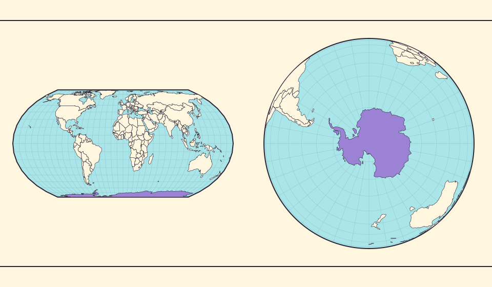
A large region around one point
The British Antarctic Survey describes an Antarctic ice sheet covering nearly fourteen million square kilometres. That scale gives context to the southern part of the world, but an ice-sheet area is not automatically the same quantity as every published continent-area figure. Read the label with the number.
Antarctica surrounds the South Pole. The bottom edge of a page is not a geographic direction that the continent must fill. A view centered on the pole makes that relationship easier to see.
Mercator’s polar problem is especially visible here
Mercator’s vertical coordinate grows without bound toward the pole. A finite rectangular display must cut the map before reaching 90° south. The remaining visible land can stretch across the lower part of the frame while the pole itself is absent.
Judging Antarctica by the width of the southern strip is unreliable: the view is strongly distorted and omits the pole. A globe or another finite polar representation makes the continent’s layout easier to see.
Bronnen: PROJ · Mercator equations
Land, grounded ice and floating ice are different layers
A polar image can contain several boundaries: exposed coast, grounded ice and floating ice. Those layers are related but not interchangeable. A seasonal ice edge should not be treated as a fixed national or continental boundary.
The Natural Earth overview is a simplified geographic dataset, not a current measurement of sea-ice extent. Use a polar research source for a question about present ice conditions. Use this map to understand the placement of the continent and the consequences of projection.
Bronnen: British Antarctic Survey · Antarctica · Natural Earth · Dataset scales
Turn the bottom strip into a polar-centered continent
Rotate the globe toward Antarctica. Coastlines stretched along the bottom of a rectangle now gather around a pole. Place the continent at the center and trace its outer coast against the ocean. Changing the viewpoint makes its geographic arrangement much easier to read.
Find the same continent on Equal Earth. It is spread out again on a flat display that preserves relative area. Compare the two views: the long southern strip belongs to the way a world map is unfolded, rather than being the continent’s shape on the globe.
Bronnen: PROJ · Mercator equations
Turn the southern strip into a continent
- Locate Antarctica on the flat world view.
- Switch to the globe and rotate toward the South Pole.
- Compare the outline with Equal Earth, while reading each figure’s caption.
The page’s bottom border is a display convention. Antarctica is a geographic region around the pole.
Open kaart →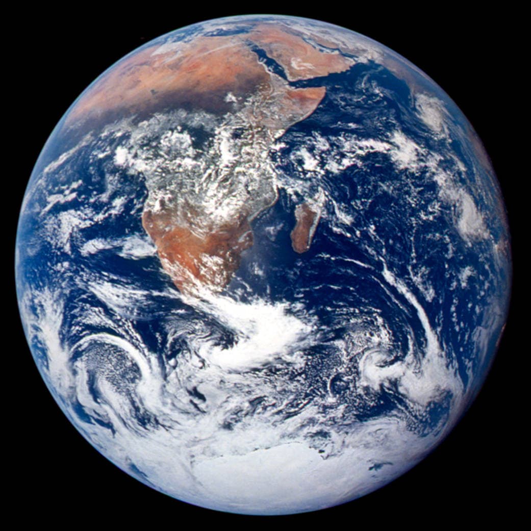
Common questions
Does the white outline show today’s sea ice?
No. The illustration uses an overview boundary dataset, not a current ice observation.
Can I measure Antarctica by the strip at the bottom?
No. Polar distortion and the display cutoff make that interpretation unreliable.
Sources and further reading
Sources checked:
Related stories
Why online maps stop before the poles
Square tiles make a world map easy to zoom, but Mercator cannot place the poles at a finite height. Learn what the missing polar strip means.
Why a country looks smaller at the globe’s edge
A globe avoids the familiar rectangular world, but its screen image still compresses the edge. Separate spherical area from visible footprint.
Pangaea was not there at the start of every timeline
At 600 million years ago, Pangaea had not yet assembled. Follow separated landmasses as they come together and later drift apart.