
This story is currently available in English and Korean. You are reading the English edition. 한국어 · English
Japan and Germany: a long shape can hide a similar area
Japan is often remembered as a thin chain of islands; Germany as a more compact shape in central Europe. How much of your first guess about their sizes comes from the land itself, and how much from the empty space around it?
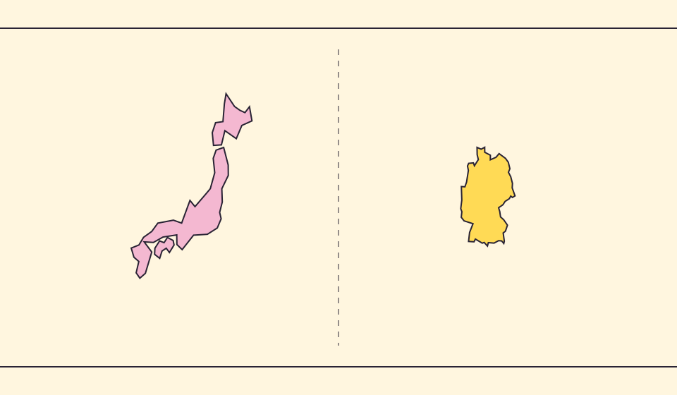
Close in scale, not identical in definition
Japan’s Geospatial Information Authority publishes a national area of roughly 378,000 km² in its survey for 1 July 2026. UNData lists Germany’s surface area as about 357,600 km², with a 2023 reference footnote. Despite their different shapes, the two countries are close in area: the island chain is not a tiny fraction of the mainland country.
They are rounded here on purpose. The two publications are not one harmonised dataset and do not share a single reference date. For a precise ranking or percentage, use matching definitions and editions. For learning to distinguish shape from area, the broad comparison is enough.
Šaltiniai: GSI Japan · Area survey (1 July 2026) · UNData · Germany: surface area (2023)
The gaps between islands are not extra land
An archipelago can occupy a large envelope on the page because its parts are separated by sea. The envelope is useful for locating the whole country, but it is not the sum of its land. A long outline can therefore feel larger or smaller depending on whether you look at its reach or its filled pieces.
In a country comparison, follow the individual islands rather than mentally colouring the surrounding rectangle. Conversely, do not discard a distant island merely because it is detached from the main cluster. The source’s territorial and geometric coverage determines what belongs in the calculation.
Small islands challenge overview maps
An overview coastline cannot represent every island at useful screen size. Natural Earth offers several source scales, and RealWorldMap’s Equal Earth overview uses 1:110 million boundaries. For Japan, the visible polygon differs from the official national inventory.
Japan’s GSI also publishes an island-count methodology. Counting depends on a defined coastline dataset and inclusion rules, rather than simply spotting disconnected coloured patches in a world map. Avoid turning the number of visible shapes into an official island count.
Šaltiniai: GSI Japan · Island-count methodology · Natural Earth · Dataset scales
Keep the reference frame consistent
Move the two selected outlines near one another on the flat comparison map. Keep the zoom fixed and pay attention to the land inside each outline. If one country remains far north of the other, projection scale can still interfere with a casual visual judgement.
Then use the globe and bring the comparison toward the center. This will not turn islands into a compact landmass, but it helps you see why a long geographic footprint is a different property from total area. Describe both properties instead of making either one stand in for the other.
Compare the filled outlines
- Search for Japan and Germany in comparison mode.
- Place the outlines close together without changing the map zoom.
- Inspect the islands individually, then compare the area definitions in the linked sources.
The empty water between islands helps describe location, but it does not become land because it sits inside a visual envelope.
Atverti žemėlapį →Common questions
Can the world map show every Japanese island?
No. Overview datasets simplify coastlines and omit small features. Consult a detailed national source for island inventories.
Does similar area mean similar geography?
No. Shape, relief, coastline and the spacing between regions are separate characteristics.
Sources and further reading
Sources checked:
Related stories
Kodėl ribos ir plotai skiriasi?
Supaprastinimas praleidžia mažas įlankas ir salas. Naudojame Natural Earth ribas masteliu 1:110 milijonų ir skaičiuojame plotus iš supaprastintų sferinių formų. Oficialūs duomenys gali kitaip įtraukti vandenis ir teritorijas. ≈ reiškia įvertį.
Russia and Africa: width is not area
Russia stretches across the top of many world maps. Compare that visual width with area, and learn why a country and a continent need different labels.
Why a country looks smaller at the globe’s edge
A globe avoids the familiar rectangular world, but its screen image still compresses the edge. Separate spherical area from visible footprint.